GIS Lite
iPad - iPhone GIS empower
Mobile Apple devices are more powerfull than ever. We envision to transform state of the art devices to powerfull GIS stations. GIS Lite is a professional mobile GIS solution that enables users to create, edit, visualise, analyse and publish geospatial information.
Local / Cloud Storage
Your spatial data is stored on the iPhone, so there’s no need for an Internet connection to see your data – great for field work. The main application folder is registered in iCloud so you can utilize shared storage with your mac and interoperate seamlessly.
Your spatial data is stored on the iPhone, so there’s no need for an Internet connection to see your data – great for field work. The main application folder is registered in iCloud so you can utilize shared storage with your mac and interoperate seamlessly.
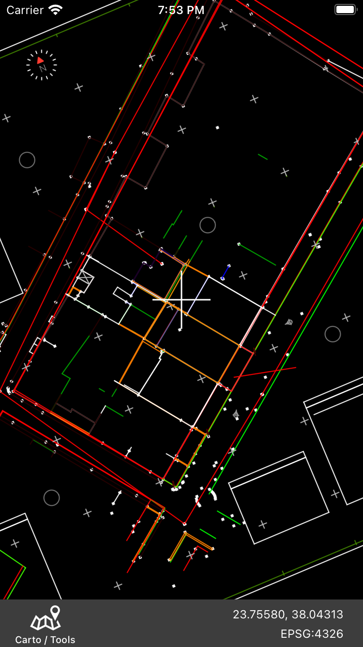
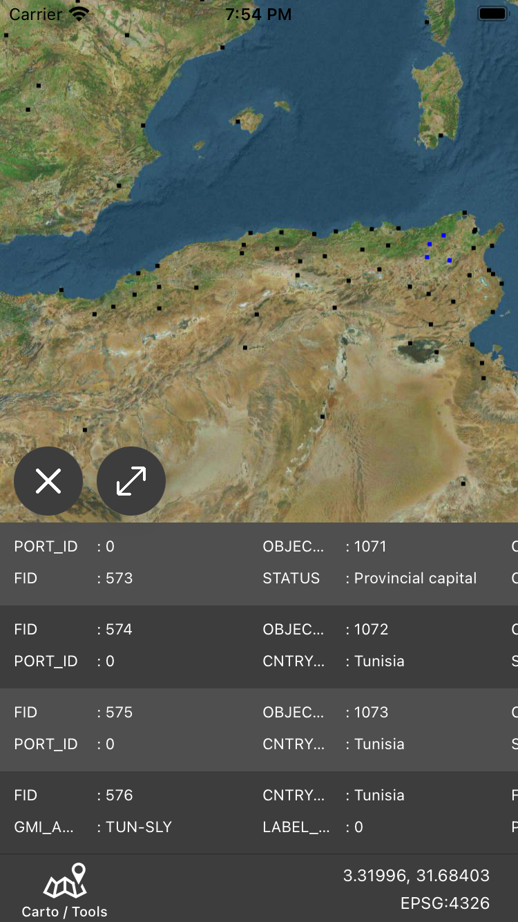
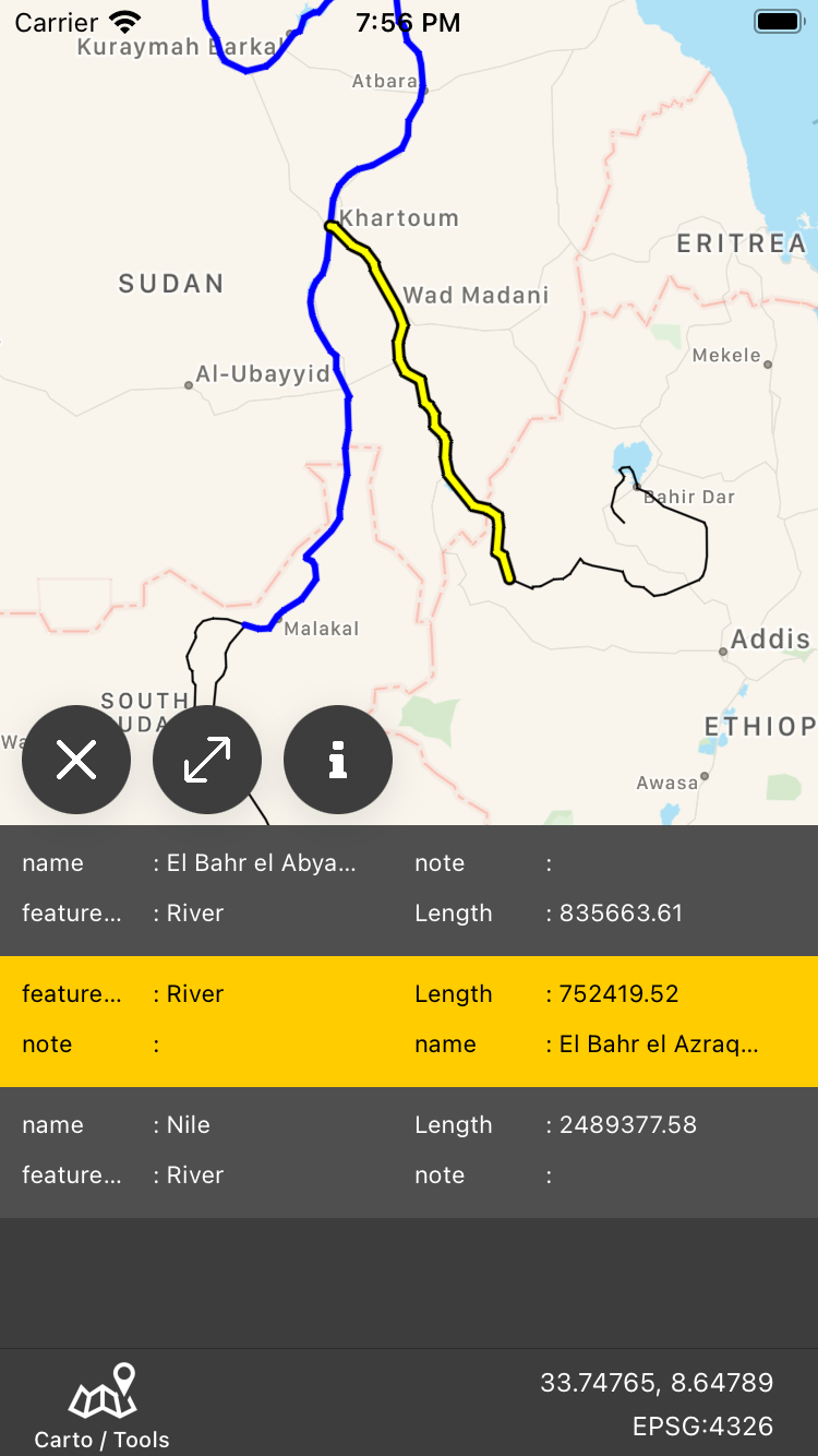
Vector file support
Our engine is continuously expanding to support natively more and more vector formats. You can load Shapefiles (.shp), DXF files (.dxf), KML files (.kml / .kmz) and more. Please feel free to suggest new implementations or feedback about file support improvements.
DXF files (.dxf)
Select your file to open from local or iCloud storage. You will need to select data projection. Layers and styles will be loaded.
Select your file to open from local or iCloud storage. You will need to select data projection. Layers and styles will be loaded.
ESRI Shapefiles (.shp)
Select your file to open from local or iCloud storage. If you want a full load (.dbf attributes and .prj file), the files must be copied in iCloud application folder (GIS_Lite). If not, you can still view your data. In that case, only geometry will be loaded and you will have to define projection.
* Rendering of geometry primitives is currently available (points / lines / polygons)
** Parsing engine is continuously updated so stay updated for more features.
** Parsing engine is continuously updated so stay updated for more features.
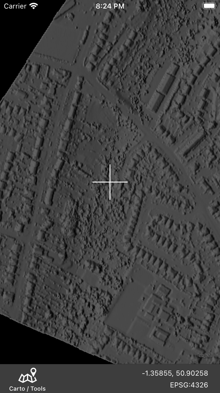
Raster Data support
Raster Data support is provided for certain file formats and keeps expanding. Currently GeoTiff files can be loaded and rendered, but also PNG, JPEG files along with the corresponding worldfile.
Raster Data support is provided for certain file formats and keeps expanding. Currently GeoTiff files can be loaded and rendered, but also PNG, JPEG files along with the corresponding worldfile.
Field Data Collection
GIS Lite integrates a field data collection module. Up to now it supports collecting point geometries and enables user to attach a name text property, a type from a user defined type list and a photo taken on field.
GIS Lite integrates a field data collection module. Up to now it supports collecting point geometries and enables user to attach a name text property, a type from a user defined type list and a photo taken on field.
Project export
Collected data can be exported to be used in desktop GIS software. The system exports a zip file containing a shapefile bundle along with the photographs taken on the field. All properties captured are attached to the corresponting dbf file.
Map Notes / Sketches
GIS Lite introduces a new functionality not seen yet in GIS domain. User has the abbility to draw on top of maps freehand. Content created can be shared and exported to GeoTiff file that can be loaded directly to any GIS system with raster support.
GIS Lite introduces a new functionality not seen yet in GIS domain. User has the abbility to draw on top of maps freehand. Content created can be shared and exported to GeoTiff file that can be loaded directly to any GIS system with raster support.
Pricing
GIS Lite is self funded and pricing schema is yet to be decided. Up to now functionality is provided for free with a few restrictions (eg 2 projects per device, max file size). Educational licences will be provided unter special terms upon finalisation.
*** Don't hesitate to send us suggestions about features you would like to see implemented.
